Saudi Aramco undertakes an unprecedented geological task on the Kingdom’s West Coast as we look to first understand, and then uncover, the treasures buried beneath the waters of the Red Sea.
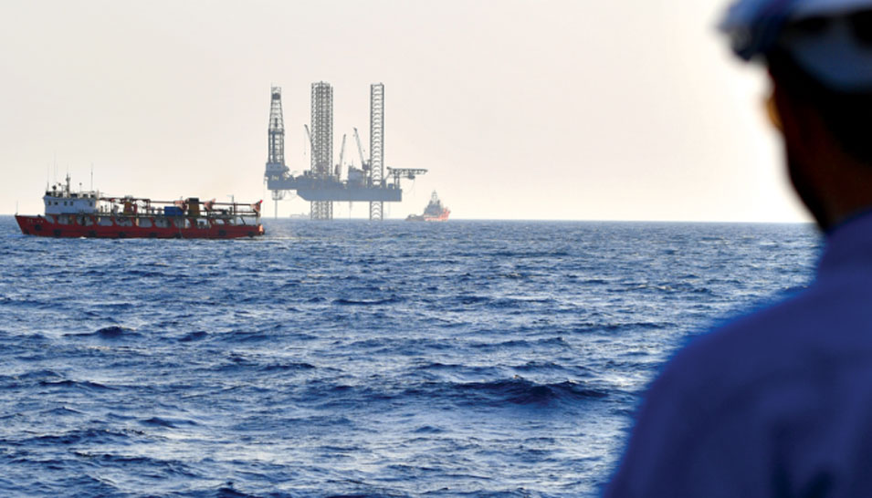
The task of mapping the seabed was colossal. Almost a decade ago, Saudi Aramco made the decision to conduct the world’s largest single hydrographic survey in the Saudi Red Sea waters — an area of almost 200,000 square kilometers (km2).
Prior 2-D seismic data acquisition had revealed positive signs for the presence of hydrocarbons in geological traps. Just like the Eastern Province in the early 1940s, the Red Sea was frontier territory — unexplored. Its development would be a catalyst to spur growth and industry in the Western Region.
A large-scale hydrographic survey — never before done in these historic waters — was required to fully understand the seafloor conditions. The hydrographic survey with its close grid analysis would help support all oil field operations, including rig movements, laying of pipelines, oil field facilities, and the routes for supply vessels.
“We got a good understanding, but lacked the topography of the seabed,” noted Saleh A. Al-Maghlouth, manager of the Exploration Operations Department. “So we undertook this groundbreaking hydrographic survey to help us better understand the structures and where to drill.”
The Challenges Were Many

“The major concerns were the time constraints and vessel safety,” observed Richard G. Moffitt, Exploration Survey Unit consultant. “These were hazardous, shallow areas previously uncharted. In fact, there were old navigation charts in existence, but from several decades ago and at low resolution — insufficient for present-day vessel navigation for exploration projects. Historically, there were many more shipwrecks in the Red Sea than there were navigation charts.”
Conventional technology at the time utilized echo sounding as a means to map underwater topography, but this would have taken many years to complete. So instead, Saudi Aramco put at its disposal the latest technology available to get the job done.
What followed were 848 days of survey operations. Five specially equipped ships would spend a combined total of 2,823 vessel days using a multi-beam echo sounder to collect data for water depths between 5 meters (m) and 2,400 m. This technology was supported by three aircraft using Airborne LiDAR Bathymetry systems for water depths between 0 m and 40 m, with a combined total of 1,260 survey flights completed.
The results were a new high resolution merged bathymetry grid allowing the mapping of complex geological features, including volcanoes on the seabed.
The data was encouraging for Saudi Aramco. The company was now able to move offshore rigs around and initial exploration could begin. But technology never stands still.
Previous 2-D seismic data had been compromised in certain sections due to the unpredictable seabed topography of the Red Sea. If plausible, a 3-D seismic survey would deliver more definitive and detailed data, and combined with the hydrographic survey, it would yield immensely useful information with a high degree of certainty.
Technological Breakthrough

Azizur R. Khan examines the node’s robotic
system on the Artemis node deployment vessel.
Just how do you image in a 3-D sense a geology as complicated as that found in the Red Sea? It was a puzzling question for geologists. Within a short distance, depths can vary from just a few meters to a few hundred meters. In addition, the area is salt dominated, with shallow carbonate on the seabed, and deep targets below salt layers of variable thickness — making any seismic operation challenging.
“We required a novel approach — something never used before,” said Azizur R. Khan, geophysical consultant with Saudi Aramco’s Geophysical Data Acquisition Division (GDAD). “We found four potential technologies, but we would have to test them. They had never been tried in an arena like the Red Sea, so we did our research and put them to the test.”
After rigorous analysis lasting almost a year, all the technologies delivered promised results — but one stood out for its efficiency and data quality: the Marine Autonomous Seismic System (MASS).
Utilizing a node-on-a-rope based system, MASS uses reinforced armored rope with a 20-ton breaking strength to place nodes on the seabed. In addition, its robotized mechanism for deployment and retrieval would add efficiency to the operation.
The MASS nodes can operate in both shallow and deep waters ranging from 1 m up to 3,000 m, utilizing one hydrophone and three omnidirectional geophones to optimize the data capturing range. Incredibly, the nodes are able to stay on the seabed for up to 65 days thanks to advanced battery life technology. In addition, high-fidelity seismic signals provide excellent imaging beneath salt formations.
So successful was the technology that it eventually cut costs of the acquisition by 40%. 3-D seismic operations were now viable in the Red Sea. For Saudi Aramco, it was all systems go.

At the rear of an air gun vessel, engineers inspect an air gun. Inspections are crucial to ensure consistency in the quality of data.
In Full Swing

Tariq H. Driwish
The day starts early for Tariq H. Driwish. At 5 a.m., the geophysicist heads to his office, and it takes him less than 30 seconds to get there. That’s because for Driwish, his office and home are almost one and the same, separated only by a room. He is the crew supervisor for 3-D Seismic Survey Crew S-78.
Based out of Duba, the crew is tasked with carrying out seismic surveys in the nearby Red Sea. This is base camp for the operation, and with 346 staff, Driwish is responsible for ensuring all runs smoothly.
Duba, on the West Coast, is a long way from home for the Dammam native. With a degree in Systems Engineering from King Fahd University of Petroleum and Minerals, Driwish is under no illusions as to the importance of his role.
“Being in a remote area and having the responsibility for the crew’s welfare, safety, and performance is a very rewarding experience,” he commented. “There is a lot of ambition and hope in this area — it’s a new frontier. We have Jazan as an example of how an area can be developed, including the local population,” added Driwish.
His day is often split between offshore and base camp duties. After receiving his morning report on the previous day’s operations, Driwish checks the health, safety, and environment status before heading to the Quality Control office. It’s here that the young geophysicist gets to review the data from the previous day’s seismic operations. Each week, geophysicists in Dhahran receive a staggering 14 terabytes of data to decipher. Driwish has to ensure that only the highest quality of information is transmitted to Dhahran for analysis.
From his office, Driwish makes the 80-minute trip to the offshore operations — it’s on the high seas where the real action takes place.
“It’s important to visit the different crews,” said Driwish. “I am tasked to make sure everything is going according to plan as per our rigorous standards. There’s never any compromise.”
All Aboard

Young GDAD geophysicist Rashed M. Al
Ghenaim inspects a marine air gun. Al Ghenaim
holds a master’s degree in geosciences.
Rashed M. Al Ghenaim stands at the rear of the Artemis, gazing out to the Red Sea waters that stretch before him. The Artemis, a deep-water node deployment vessel, moves effortlessly through the Red Sea as it unleashes scores of nodes connected to a reinforced steel rope deep into the seas it traverses.
Al Ghenaim, a 28-year-old geophysicist with GDAD, is surrounded by a dazzling array of technology that is collecting invaluable data from the seabed below. It’s this information that is reviewed by Driwish at the base camp. A geophysical engineering graduate from the Colorado School of Mines, Al Ghenaim’s role is to act as a focal point between the survey team and operations, spending time both in Dhahran and in the field.
“Offshore operations have a lot of challenges, but the technology we have at our disposal is truly incredible,” said Al Ghenaim. “It’s amazing when you see it in action, everything is so precise and fine. It’s the Saudi Aramco way.
“In Dhahran, I work on projects involved in the survey designs, so it’s great to get to the field and see the actual operation and where the data is being generated,” he added.
“Both in the field and in the office, there are senior geophysicists who are always ready to offer advice and help. I don’t miss those opportunities.”
The Artemis robotically deploys and retrieves nodes that it lays in deep waters. Once the nodes are in their predetermined positions, they act as standalone recording systems, ready at an instant to pick up seismic signals emanating from geological layers as deep as 10 km inside the Earth, and as well as from acoustic energy traveling through the water. The acoustic waves are generated by air gun source vessels.
On the seabed at various depths are 3,000 nodes, each with the capacity to store 128 gigabytes of data. In place, it’s now down to the air gun vessels to do their business.
“Different geological layers have different densities and different velocities of seismic waves through them,” observed Khan. When in operation, the air gun vessels fire every 10 seconds, reaching around 5,000 shots per day. The shots are essentially high-pressure air that is unleashed into the sea.

Firing every 10 seconds when in operation, the air gun shots, reach an average of 5,000 shots per day. It’s the acoustic waves generated by these shots that is picked up by the nodes on the sea floor, creating crucial seismic data.
Bringing it Together

Hussain N. Al Ghanim examines one of the
marine nodes before deployment.
“We have a challenge making sense of all this data,” observed GDAD’s Hussain N. Al Ghanim. “But we work closely with the geologists and other partners across Exploration to interpret what we have — it’s not easy, but we get there.
“Everything about this operation amazes me, but what stands out the most are the nodes on the seabed floor,” he continued. “They are able to stay at such depths for more than a month at a time storing and collecting data. The speed is incredible and it’s a true breakthrough in seismic. Combined with our computing technology, data that would have taken us years to acquire and process now takes only months — what a leap.”
The 3-D seismic operation in the Red Sea is yielding unprecedented results. The Kingdom and Saudi Aramco’s vision are in full swing in this region, and 3-D seismic is at the heart.